We’ve spotted a trend that shows boaters with tight helm spaces still expect big-boat functions from their electronics. Here are three products that give full chart-plotting and bottom-finding functions and a couple that even are radar and Sirius satellite radio capable.
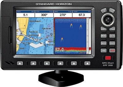
Standard Horizon
CPF300i
$1,000; standardhorizon.com
The CPF300i boasts a built-in 50-channel GPS antenna that delivers position accuracy up to 10 feet. We appreciate the color high-resolution 800 x 480 display, made to be viewed even in direct sunlight, and value the unit’s innovative ability to connect to a mounted VHF radio with DSC polling and display the location of a vessel with an activated AIS signal right on the screen. Standard Horizon simplified chart plotting with dedicated “mark” and “route” keys to create a route on the screen.
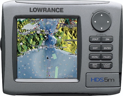
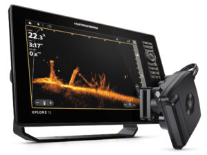
Lowrance
HDS-5m
$600; thegpsstore.com
Lowrance’s compact treasure packs quite a punch in the “can-do-it-all” arena of multifunctional navigation with its new broadband HDS chart plotter and sonar that are high-definition radar capable. The high-def 5-inch screen is surprisingly bright and provides clear vessel positioning and detailed views of underwater topography. Plus, with add-ons like Sirius satellite weather, you can overlay real-time weather and pipe satellite radio straight through it to your boat’s sound system.
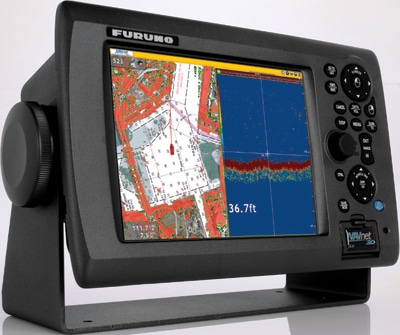
Furuno
MFD8 NavNet 3D
$3,195; amazon.com
This radar capable 8-inch Furuno has “zero time” chart-plotting technology that allows for super-fast and seamless zooming and scrolling. Opt for the traditional 2-D view, or with the simple twist of a control, get a 3-D look at all the angles. Preloaded with tides, currents and the entire NOAA raster-chart library for the complete U.S. coastline, the fully compatible NavNet 3D now accepts Jeppesen C-Map cartography for unbeatably complete navigation detail and coverage.