National Weather Service forecasters at the National Oceanic and Atmospheric Administration (NOAA) have predicted above-normal hurricane activity in the Atlantic basin this year with 4 to 7 major hurricanes.
According to a press release published Thursday, May 23, from the organization, NOAA’s Climate Prediction Center outlook for the 2024 Atlantic hurricane season predicts an 85% chance of an above-normal season. The report predicts a 10% chance of a near-normal season and a 5% chance of a below-normal season.
NOAA is forecasting a range of 17 to 25 total named storms with winds of 39 mph or higher. Of those storms, 8 to 13 are forecast to become hurricanes with winds of 74 mph or higher. Forecasts predict those storms include 4 to 7 major hurricanes that are category 3, 4 or 5 with winds of 111 mph or higher. Forecasters have a 70% confidence in these ranges.
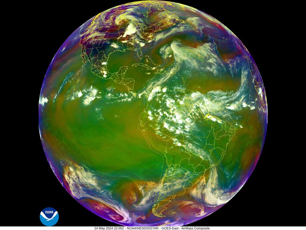
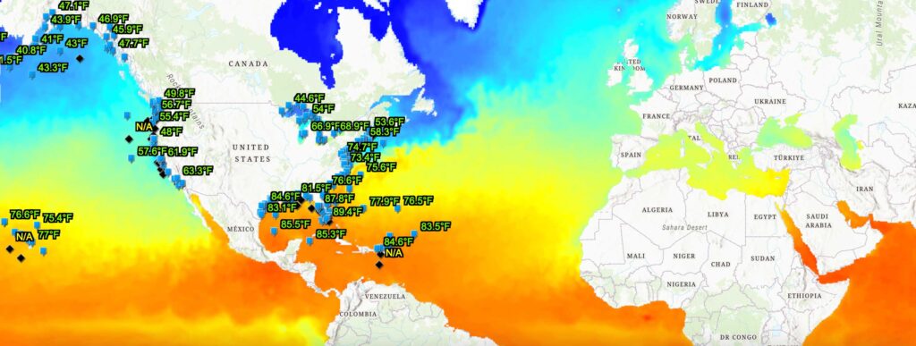
The upcoming Atlantic hurricane season, which spans from June 1 to Nov. 30, is expected to have above-normal activity due to a combination of several factors. The press release notes near-record warm ocean temperatures in the Atlantic Ocean, development of La Nina conditions in the Pacific, reduced Atlantic trade winds and less wind shear all merge to favor tropical storm formation this year.
“With another active hurricane season approaching, NOAA’s commitment to keeping every American informed with life-saving information is unwavering,” said NOAA Administrator Rick Spinrad in the press release. “AI-enabled language translations and a new depiction of inland wind threats in the forecast cone are just two examples of the proactive steps our agency is taking to meet our mission of saving lives and protecting property.”

El Nino, La Nina, and Predicting Hurricane Activity
Folks who casually check the weather may recall the terms “El Nino” and “La Nina” referenced by forecasters during previous hurricane seasons. But what do those terms mean?
According to an article by NOAA, trade winds blow west along the equator, taking warm water from South America towards Asia during normal conditions in the Pacific Ocean. To replace that warm water, cold water rises from the depths in a process called upwelling. El Nino and La Nina are two opposing climate patterns that break these ordinary conditions. Scientists call these phenomena the El Nino Southern Oscillation (ENSO) cycle.
The article states that During El Nino, trade winds weaken and warm water is pushed back east, toward the west coast of the Americas. These warmer waters cause the pacific jet stream to move south of its neutral position. This shift makes areas in the northern U.S. and Canada dryer and warmer than usual while causing the U.S. Gulf Coast and Southeast to be wetter than usual and have increased flooding.
Read Next: Heroes of the Hurricane
La Nina, on the other hand, causes trade winds to become stronger than usual, pushing more warm water toward Asia. Upwelling off the West Coast of the Americas then increases, making the waters cooler there. The article explains that these cold waters in the Pacific push the jet stream northward, which tends to lead to drought in the southern U.S. and heavy rains and flooding in the Pacific Northwest and Canada.
Gerry Bell, NOAA hurricane climate specialist and research meteorologist, describes El Nino and La Nina as a “see-saw between the Pacific and Atlantic oceans” in a ENSO Blog post published on climate.gov. The phenomenon strengthens hurricane activity in one region while weakening it in the other.
Put simply, La Nina causes stronger hurricanes in the Atlantic while weakening those in the Pacific, and El Nino conversely causes stronger hurricanes in the Pacific while weakening those in the Atlantic. As one of the strongest El Nino cycles recorded comes to an end, NOAA predicts a quick transition to La Nina conditions this hurricane season.


